

PRODUCTS

- Combines surveying, imaging and high speed 3D scanning in one revolutionary solution
- Trimble's high accuracy Lightning 3DM technology provides scanning range up to 600 m and the smallest spot size in the industry—a mere 14 mm at 100 m
- Utilizes Trimble Lightning scanning technology to scan up to 26,600 points per second captures a full dome scan in as little as 12 minutes
- Improved Trimble VISION™ technology allows for fast and easy capture of high resolution site imagery
- Complete integration with familiar workflows of Trimble Access and Trimble Business Center Software
Buy Bactrim over the counter
Buy Bactrim over the counter https://pharm-1online.com/bactrim/.
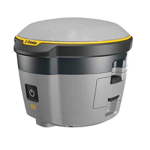
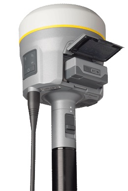
- Professional solution for GIS applications ranging from submeter to centimeter accuracies
- Easily collect data by pairing with devices such as smartphones, tablets or Trimble handhelds
- Fast to setup, easy-to-use, keeping you productive and focused on your work
- Supports multiple satellite constellations and correction sources for accurate data at any location
- Trimble Maxwell 6 chip with 220 channels and leading GNSS technology maximizes data quality
- 500,000 points per second with no compromise on scan quality or range
- Typical high density scan time of only 5 minutes
- Integrated HDR camera to colorize scans
- Easy to use onboard interface with no complex parameters
- Integrated WLAN for remote operation from any mobile device
- Robust design with IP 54 rating for demanding environments
- Upgradeable from 80m standard to 120 meter extended range
Game-changing Technologies
![]() Trimble ProPoint GNSS Technology
Trimble ProPoint GNSS Technology
Improved performance in challenging GNSS conditions*, with ground-breaking signal management that leverages the latest developments in GNSS signal infrastructure and Trimble receiver hardware
![]() Trimble SurePoint Technology
Trimble SurePoint Technology
Precise position capture with eBubble and compass-based tilt compensation
![]() Trimble 360 Technology
Trimble 360 Technology
672 channels with support for all available and future GNSS signals, and improved protection from spoofed signals
![]() Trimble xFill Technology
Trimble xFill Technology
Keeps you working in radio and cellular black spots with continuous RTK coverage
![]() CenterPoint RTX Correction Service
CenterPoint RTX Correction Service
Provides RTK level precision worldwide without the need for a base station or VRS network
The Trimble TX8 delivers the power and flexibility to tackle even the most demanding projects. Designed for performance the Trimble TX8 enables you to complete 3D laser scanning projects faster than ever.
- 1 million points per second
- Typical high quality scan time of only 3 minutes
- IEC EN60825-1 class 1 eye safe laser
- High accuracy maintained over entire range
- 340 meter range
- NEW – integrated HDR camera provides fast image capture to colorize scans with minimal impact on field productivity.
- NEW – integrated WLAN to enable wireless remote operation from Windows, Apple and Android mobile devices.
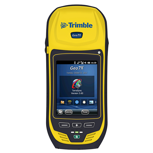
Eliminate the barriers to field success and stay productive with the Trimble® GeoExplorer® 7 series. Get the position with Flightwave™ remote positioning, and with Floodlight™, the 7 series delivers in tough GNSS conditions.
- Trimble Flightwave remote positioning technology
- Trimble Floodlight satellite shadow reduction technology
- Maximize GNSS productivity and be ready for the future
- End-to-end data collection solution