

PRODUCTS
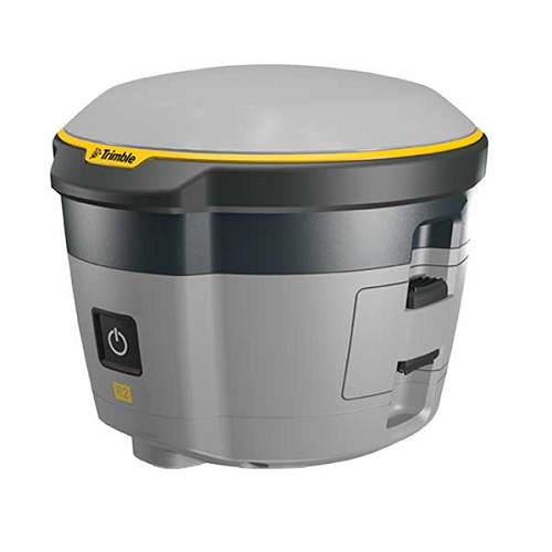
- Professional solution for GIS applications ranging from submeter to centimeter accuracies
- Easily collect data by pairing with devices such as smartphones, tablets or Trimble handhelds
- Fast to setup, easy-to-use, keeping you productive and focused on your work
- Supports multiple satellite constellations and correction sources for accurate data at any location
- Trimble Maxwell 6 chip with 220 channels and leading GNSS technology maximizes data quality
Game-changing Technologies
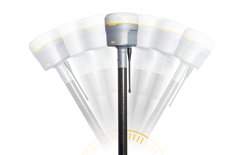
![]() Trimble ProPoint GNSS Technology
Trimble ProPoint GNSS Technology
Improved performance in challenging GNSS conditions*, with ground-breaking signal management that leverages the latest developments in GNSS signal infrastructure and Trimble receiver hardware
![]() Trimble SurePoint Technology
Trimble SurePoint Technology
Precise position capture with eBubble and compass-based tilt compensation
![]() Trimble 360 Technology
Trimble 360 Technology
672 channels with support for all available and future GNSS signals, and improved protection from spoofed signals
![]() Trimble xFill Technology
Trimble xFill Technology
Keeps you working in radio and cellular black spots with continuous RTK coverage
![]() CenterPoint RTX Correction Service
CenterPoint RTX Correction Service
Provides RTK level precision worldwide without the need for a base station or VRS network
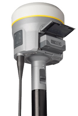
- One configurable receiver that is scalable for future needs
- Available in post-processing, base only, rover only, or base & rover configurations
- Advanced satellite tracking with Trimble 360 receiver technology
- Includes Trimble Maxwell 6 chips with 440 channels
- Simple integration with Trimble S-Series Total Stations and the V10 Imaging Rover
- Intuitive Trimble Access Field Software and Trimble Business Center Office Software
- Trimble DL Android app for collecting static GNSS raw data for post-processing

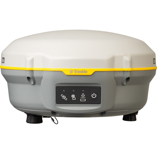
- Professional solution for survey-grade workflows
- Submeter to centimeter level accuracies
- Fast to setup, easy-to-use, keeping you productive and focused on your work
- Supports multiple satellite constellations and correction sources for accurate data at any location
- Trimble Maxwell 6 chip with 220 channels and leading GNSS technology maximizes data quality
- Easily collect data by pairing with a Trimble handheld controller
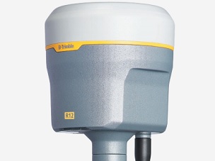
More than 30% better performance in challenging environments
- ProPoint GNSS Technology
- Trimble 360 Technology
- Trimble xFill Technology
-Trimble SurePoint
- CenterPoint RTX Corrections
- 8mm H / 15mm V
- 672 GNSS Channels
- Android & iOS
-
 Trimble ProPoint GNSS TechnologySuperior performance in degraded GNSS conditions, with groundbreaking signal management that leverages the latest developments in GNSS signals and Trimble receiver hardware
 -
 Trimble TIP Tilt Compensation TechnologyInertial Measurement Unit (IMU) based tilt compensation for accurate laying out and measuring points without precisely leveling the pole
 -
 Trimble CenterPoint RTX® Correction ServiceProvides RTK level precision worldwide without the need for a base station or VRS network
-
 Trimble 360 Technology672 channels with support for all available and future GNSS signals, and improved protection from interference and spoofed signals
 -
 Trimble xFill® TechnologyKeeps you working in radio and cellular black spots with continuous RTK coverage
 -
 Augmented Reality ReadyBring geospatial data to life and visualize your 3D data in the real world with Trimble SiteVision™ on the Trimble TSC7 controller