

PRODUCTS
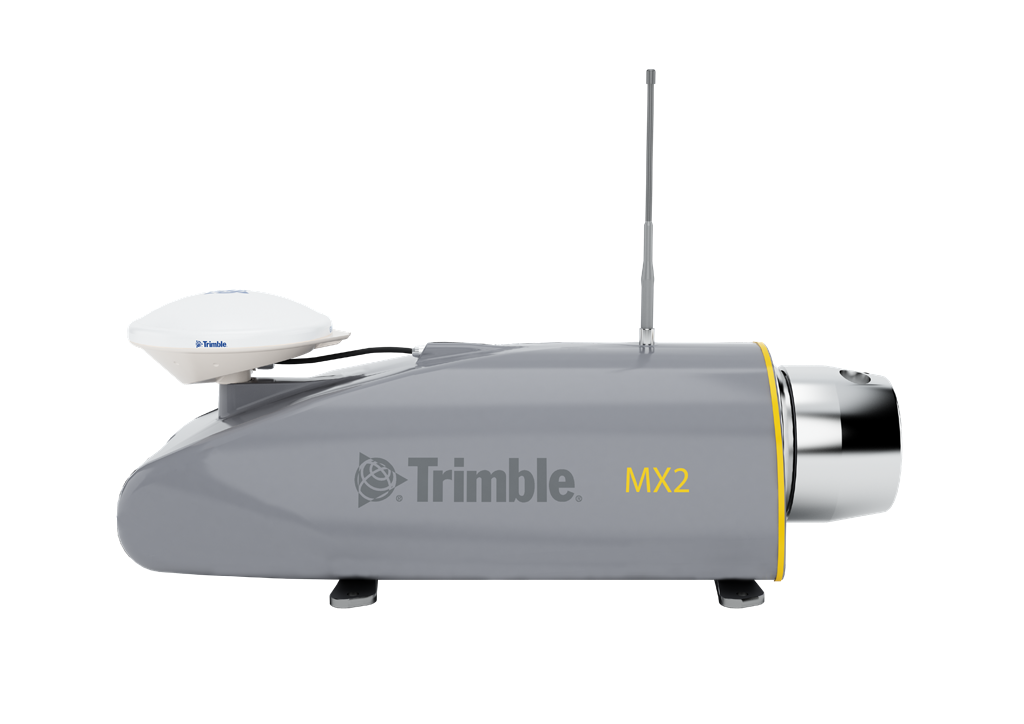
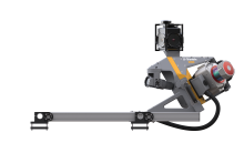
The Trimble MX2 is built to extend the capabilities of a field surveyor, and safely and effectively addressing difficult projects. It enables surveyors to enter the world of mobile scanning with a manageable path to achieving return on investment and effective cost per collected point, accelerating projects and offering new capabilities to help win competitive tenders.
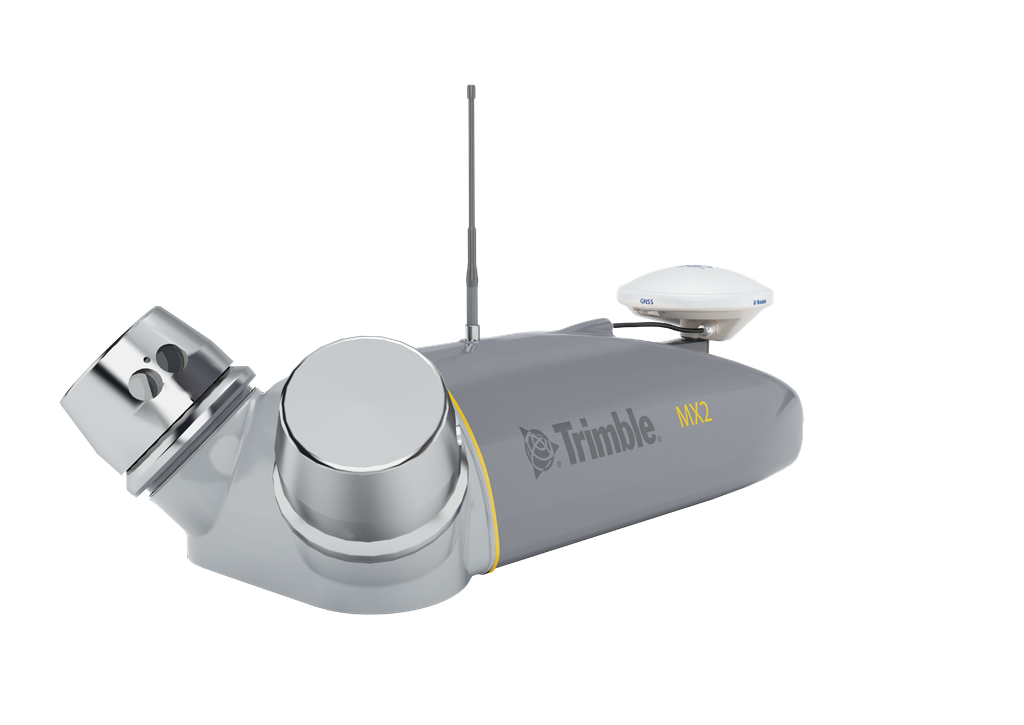
Designed for mapping, surveying and engineering environments, the Trimble MX2 is rugged, lightweight and portable, and is easily deployed and redeployed, on a project, like conventional surveying equipment. A precise laser scanner, along with an embedded Trimble- Applanix GNSS/Inertial positioning system, creates point cloud accuracies necessary for many spatial imaging projects.
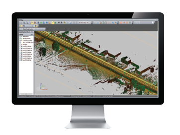
Trident Imaging Hub includes the following features
- Point Cloud viewing and navigation in 3D
- 3D Measurements
- Imaging Playback, Image and Point Cloud blending
- Point Selection & Classification Tools
- Trajectory Import
- Image Converter
- Camera/Laser Boresight Calibration
- RGB Point Cloud Colorization
- Target Detection/Registration
- SHP/DXF Import and Export
- Database Connectivity
- Point Cloud Export (optional by Class) in LAS 1.1/1.2/1.4 or csv
- Photogrammetric / Point Cloud Feature addition
- Pavement Defects Report
Versatile system offers significant operational flexibility. Six 5MP cameras provide rapid 360 degree image documentation with high precision positioning using tightly coupled GNSS and inertial referencing system. It uses Trimble Mobile Imaging capture software and Trimble Trident office for data capture, extraction and analysis.
- Very high point cloud density and immersive imagery
- State of the art Trimble GNSS and Inertial technology
- Dual and single laser configuration available to match customer needs
- Lightest and most compact premium mobile mapping system
- Simple installation and browser based operation from a smart device
- Data processing in Trimble Business Center (TBC)
- Trimble MX software for feature extraction and data publishing