

PRODUCTS
Features
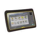
- Fully rugged construction including Gorilla® Glass panel display
- 7 inch capacitive touch dual technology display system delivers enhanced, sunlight readability
- Windows 7 Operating system brings the office to the field
- Built-in 5 MP camera for unprecedented image documentation
- Integrated communication technology provides increased connectivity
- Optimized for Trimble Access field software workflow support

Trimble 4D Lite is a cloud-based application that is designed with an interface familiar to existing Trimble monitoring technology users. T4D Lite is designed for surveyors, engineers and scientists to perform campaign monitoring of data/time series without the need to integrate directly with onsite hardware and sensors. Trimble 4D Lite can be used to meet campaign monitoring needs of installations on dams, bridges, mines, landslides, buildings and other natural and man-made hazards or structures using sensors to monitor health. Data can be integrated from a wide range of sensors. The data can be visualized and analyzed on a variety of interactive charts and scatter plots and the sensors can be viewed in context with the structure using a variety of backdrops including maps, plans or photographs.
Available Industries
- Bridge
- Dams
- Mines
- Buildings
- Utilities
- Tunneling
- Environmental
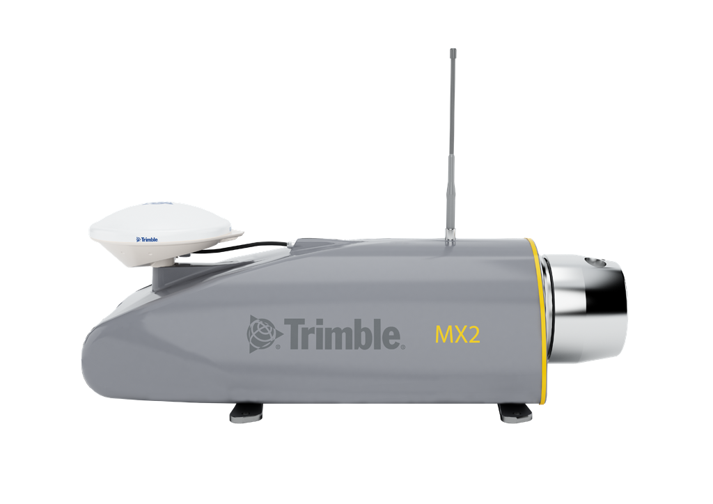
The Trimble MX2 is built to extend the capabilities of a field surveyor, and safely and effectively addressing difficult projects. It enables surveyors to enter the world of mobile scanning with a manageable path to achieving return on investment and effective cost per collected point, accelerating projects and offering new capabilities to help win competitive tenders.
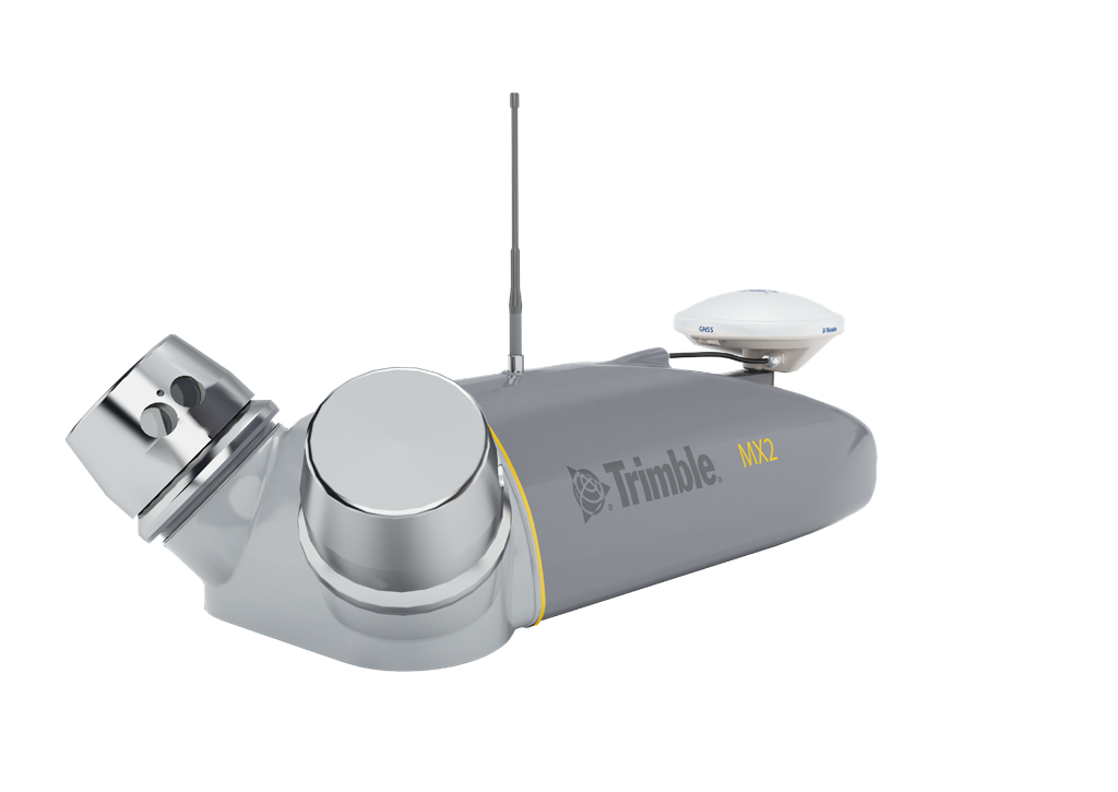
Designed for mapping, surveying and engineering environments, the Trimble MX2 is rugged, lightweight and portable, and is easily deployed and redeployed, on a project, like conventional surveying equipment. A precise laser scanner, along with an embedded Trimble- Applanix GNSS/Inertial positioning system, creates point cloud accuracies necessary for many spatial imaging projects.
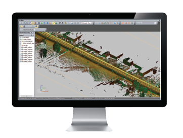
Trident Imaging Hub includes the following features
- Point Cloud viewing and navigation in 3D
- 3D Measurements
- Imaging Playback, Image and Point Cloud blending
- Point Selection & Classification Tools
- Trajectory Import
- Image Converter
- Camera/Laser Boresight Calibration
- RGB Point Cloud Colorization
- Target Detection/Registration
- SHP/DXF Import and Export
- Database Connectivity
- Point Cloud Export (optional by Class) in LAS 1.1/1.2/1.4 or csv
- Photogrammetric / Point Cloud Feature addition
- Pavement Defects Report
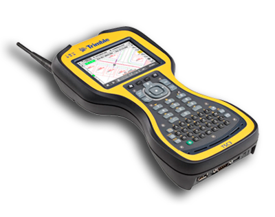
Your rugged workhorse for site measurement, stakeout, and grade checking operations, the TSC3 gives supervisors, foremen, grade checkers and site engineers total control of site operations.
Features:
Rugged, Durable design
Easy to use software
Cable free operation
Connectivitiy
Trimble Remote Assistant
A 4.2 inch, high-resolution LCD touchscreen display and alphanumeric keypad that make it easy to enter data
Integrated 3G modem that gives instant access to the Internet for receiving base station corrections, emailing and synching files
Integrated GPS and 5MP camera to collect site information for documentation and quality control
Optional 2.4 GHz radio that gives it flexibility for GNSS or total station operations