Warning: mysql_fetch_array() expects parameter 1 to be resource, boolean given in C:\xampp\htdocs\www\include\functions.php on line 9

Warning: Invalid argument supplied for foreach() in C:\xampp\htdocs\www\include\functions.php on line 11

Warning: mysql_fetch_array() expects parameter 1 to be resource, boolean given in C:\xampp\htdocs\www\include\functions.php on line 130
 
 
SOFTWARES
Triton Imaging Perspective
Suite has the tools needed to provide the highest quality results
A complete software tool set for
production processing of sidescan and bathymetry data from interferometric sonars. Designed around Triton’s unique Perspective architecture, this package is easy to use, versatile, produces sidescan mosaics of the highest quality, and delivers fast throughput on very large survey data sets. IncludesTriton’s Perspective Map,
BathyOne, 2D/3D sounding editors,
MosaicOne, TargetOne, and SeaClass modules
 
Whether surveying for hydrography, mine hunting, subsea developments, harbor security, natural
resource exploration, habitat mapping, or scientific research, Triton IFM
 
Available modules:
  • IFM
  • SBP
  • Perspective
 
Datasheet Datasheet Datasheet
Triton Imaging ISIS
An Integrated collection
Modules Available
  • IFM: Integrated collection of Triton Sotware modules that provides everything needed to accuractly acquire and review data from most of interferometric sonars.


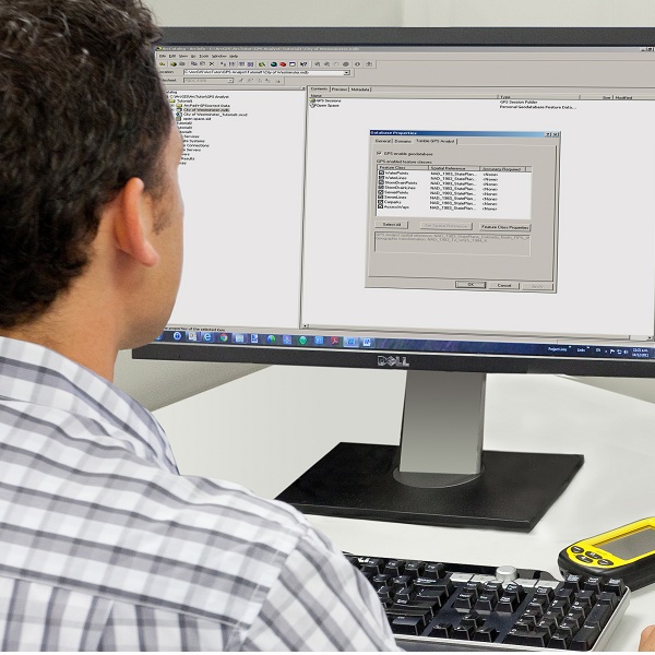
  • SBE: Integrated collection of Triton software modules that supports the data acquisition, line planning, survey execution, and quality control for surveys
    conducted with singlebeam echosounder sonars. This package is designed to provide everything needed to plan
    and conduct a quality bathymetric survey. Included in this package are Triton Nav and Triton Map, and a real
 
  • SBP: Package is an integrated
    collection of Triton software modules that provides everything needed to accurately acquire and review high resolution seismic data from most subbottom profilers and analog sparker boomer systems.
 
  • SSS:  Package is an integrated
    collection of Triton software modules that provides everything needed to accurately acquire and review high resolution seismic data from most subbottom profilers and analog sparker boomer systems.
Datasheet Datasheet Datasheet Datasheet
Chesapeake Sonarwiz 7.5
See your sonar data like never before
 
You work hard to get the data – make sure you see all that it has to show. SonarWiz Data Acquisition and Post Processing Software for Seafloor mapping, Sidescan Sonar, Sub-bottom Profiler, Bathyemetry, Magnetometer Easy to acquire, Process and Interpret Sonar Data. SonarWiz software helps with sonar mission planning, data acquisition and post processing to ensure you use your time on the water effectively and capture all of the data you need before heading back to port.
 

Request a free evaluation: Chesapeake Sonarwiz7.5

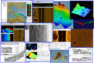
This complete, easy to use solution increases surveyor productivity, simplifies the planning process, and enables you to produce high quality results. Description and Benefits SonarWiz is an all-in-one suite of programs for the real-time acquisition of sonar data, designed to meet all of your sonar mapping needs, save you time, and minimize your training costs. Whatever your role – commercial sonar, oil & gas, navy and coast guard, education, construction, salvage, or research - SonarWiz helps you streamline the survey process and simplify the number of software programs you need to learn. It operates with all major sidescan and sub-bottom sonar manufacturers, so you won’t need to re-familiarize yourself with different applications each time you need to use different sonar equipment.


Features
  • Only have to learn one powerful, easy to use software to complete any sonar survey
  • Advanced interactive planning tools lead to efficient and cost effective survey time on the water
  • Reduce costs by using real-time data acquisition to confirm quality and coverage before leaving operation area
  • Customize computer desktop to meet job requirements, save and recall setup for easy setup of subsequent missions
  • Intuitive interface follows survey workflow methodology making it easy to start using the system immediately
  • Results are easily shared with anyone using Internet Explorer
  • Unsurpassed on-site training and customer support to ensure you get the most from your investment


Sidescan Bathymetry Magnetometry Sub-Bottom
Triton Imaging SurveyPro
An Integrated Collection of SurveyPro
Triton’s new SurveyPro
 
SBP package is an integrated collection of Triton software modules that supports the planning, execution, and quality control for subbottom profiler surveys. It is designed to be used in conjunction with the Triton subbottom data acquisition package, ISIS Offshore
 
SBP SurveyPro
 
SBP pro vides everything needed to plan and conduct a high resolution seismic survey. Includes the Triton Nav and Triton Map modules operating inan integrated environment
Datasheet Datasheet Datasheet
Trimble eCognition
The most powerful solution for analysis & extraction
Trimble eCognition software is a powerful solution for the analysis and extraction of information from geospatial data collected via aerial, satellite and mobile mapping platforms. This new release simplifies and reduces the time taken to classify objects in imagery data sets using the new template matching function. With eCognition 9, users can define objects graphically to streamline the template creation process. These templates are used to automatically identify objects of interest in imagery. 
 
In addition, remote sensing and Geographic Information System (GIS) professionals can now integrate data layers more efficiently through improved GIS tools within eCognition 9. These capabilities provide a framework for advanced analysis that allows professionals to use eCognition to resolve a larger range of geospatial queries and obtain more accurate results.
 
"With the fast growth of imaging and remote sensing data collection, geospatial professionals need faster and simpler methods to analyze and extract meaningful information from the data," said Alain Samaha, business area director of Trimble's Geospatial Software Solutions Division. "eCognition 9 takes simplification and integration to a new level while augmenting the precision and accuracy of results. This opens the door to a wider range of applications across multiple industries."
 
Datasheet
GPS analysist
GPS analysist
Streamlined GNSS data processing inside Esri ArcGIS 
Take a giant leap forward in productivity and improve your data quality with Trimble® GPS Analyst™ extension for Esri ArcGIS for Desktop software. Trimble GPS Analyst extension optimizes your field-to-office workflow by allowing you to work directly with GNSS data inside your personal geodatabase. And because the extension comes with a package of powerful GNSS postprocessing tools, incorporating Trimble DeltaPhase™ differential correction technology, you can be sure you have GNSS data that is consistent, reliable, and accurate.
 
Let Trimble GPS Analyst extension for Esri ArcGIS for Desktop improve your data accuracy and your field-to-office workflow by making GNSS data an integral part of your GIS. A customizable extension that allows you to work directly with GNSS data directly inside the Esri ArcGIS for Desktop software, Trimble GPS Analyst extension is the ideal platform for industries from utilities to resource management to government organizations and more.
Trimble GPS Analyst extension is perfect for Esri ArcGIS software customers that:
Use Esri ArcPad and Trimble GPScorrect™ extension for Esri ArcPad software or Trimble TerraSync™ software as their field application
Use notebook or tablet applications in the field
Develop custom office or field applications
To discuss how Trimble GPS Analyst extension for Esri ArcGIS for Desktop software can streamline your GPS data processing contact your local Trimble reseller.
Datasheet