

PRODUCTS

Based on the Valeport miniSVS, the UV-SVP offers a form-factor designed for Underwater Vehicles where space is at a premium. Incorporating Valeport’s class leading time of flight sound speed sensor, a PRT temperature sensor and a 0.01% pressure sensor in a compact package weighing just 750 grams (in air), the lightweight titanium housing gives a depth rating of 3000m. A wide range (9-30V DC) isolated power supply and RS232 communications complete the package.

Select the suitable transducer for your job
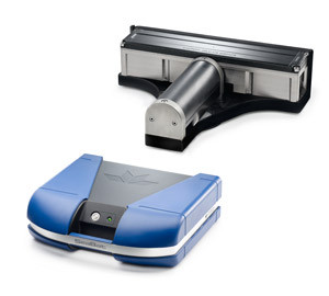
The SeaBat T50-P is the new addition to the leading SeaBat T-series product range engineered from the ground up to evolve with your business. Combined with the Portable Sonar Processor the SeaBat T50-P provides unprecedented survey data, providing faster operational surveys and reduced processing time.
- Standard Beams 512
- Max Beams 1024
- Real Time Pipe Detection and Tracking(Optional)
- Multi-Detect (Optional)
- Water Column Visualisation
- Selectable Beam Density
- Tracker (Automation)
- SeaBat User Interface
- X-Range (Optional)
- Normalized backscatter
- FlexMode

The system integrates a Trimble dual antenna GNSS receiver with the IMU sensor into one housing that allows a tightly coupled solution - resulting in the most robust positioning solution possible. The system will keep delivering position and attitude even when used in compromising marine situations such as a congested port. Its performance surpasses the systems put together from a dual GNSS antenna receiver cabled to an IMU (Pitch Roll Heave) sensor - The Trimble Marine Inertial Positioning Systems is offered at a competitive price point, and it delivers a more robust solution.
The system can deliver data while dead reckoning in cases where satellite coverage is limited for short periods so you keep productivity up. The unit can be used on new installations or as a drop-in replacement to your existing system. The real-time data outputs are legacy NMEA-type messages, including heave, that your existing marine software will be able to import.
Accuracy and Corrections
The system comes with the capability to track all the constellations - GPS, GLONASS, BeiDou, QZSS, and Galileo. It can obtain corrections from:
- A GNSS base station or VRS™ system and deliver precise RTK positions
- A subscription to MarineSTAR for base station free corrections
- SBAS corrections (EGNOS, WAAS, GAGAN, MSAS)
- Vertical beam provides more precise bathymetric data and improved characterization of slopes and irregular river beds
- Ease of use—easy to carry, easy to deploy, and easy to operate. Just power and go!
- Qrz-control—automatic adaptive sampling continuously optimizes your discharge measurement from bank to bank, thus ensuring the highest quality data without your intervention
- Versatile—a single instrument can now deliver high quality data in a 0.5 m stream or a 40 m river.